Project
Information
The Devil Canyon Project (Project) is part of a larger water storage and delivery system, the State Water Project (SWP), which is the largest state-owned and operated water supply project of its kind in the United States. The SWP provides southern California with many benefits, including affordable water supply, reliable regional clean energy, opportunities to integrate green energy, accessible public recreation opportunities, and environmental benefits.
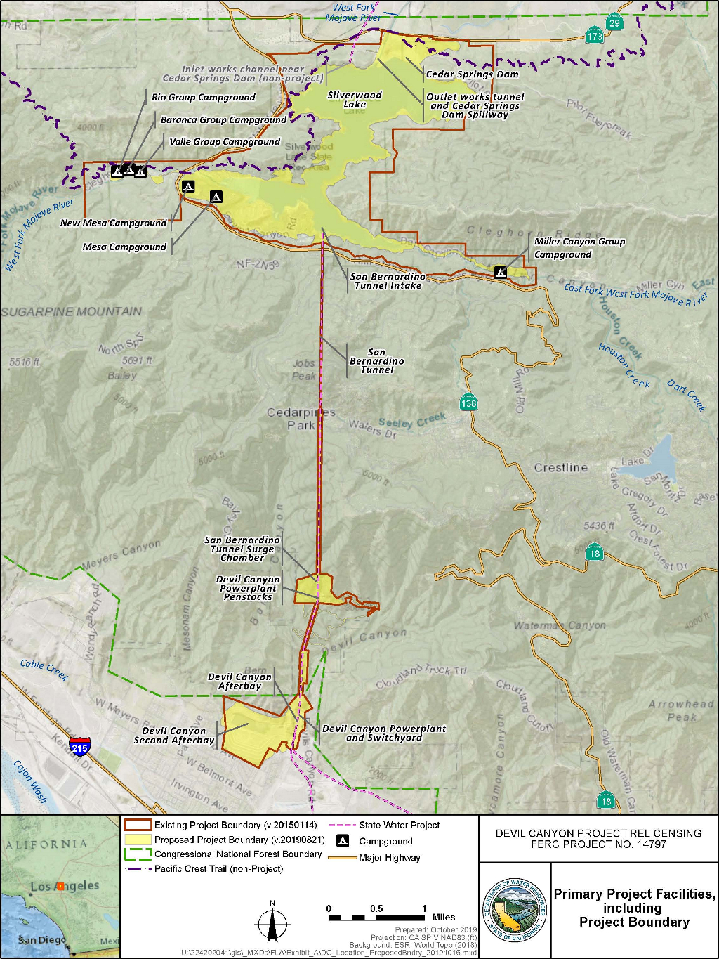
The Project, with an authorized installed capacity of 280 megawatts (MW), is located in San Bernardino County at the southern end of the East Branch of the SWP. The East Branch conveys water from the SWP’s Tehachapi Afterbay through the Alamo Powerplant, Pearblossom Pumping Plant and Mojave Siphon Powerplant before entering Silverwood Lake, the upstream end of the Project. The Alamo and Mojave Siphon Powerplants are generation facilities, each of which is individually regulated by the Federal Energy Regulatory Commission (FERC) through a conduit exemption (FERC Project Nos. 14579 and 14580, respectively). During typical operations, water is delivered from the downstream end of the Project through five different pipelines to meet water supply demands.
The Project’s primary facilities range in elevation from 5,377 feet to 1,778 feet and include Cedar Springs Dam, Silverwood Lake, San Bernardino Tunnel, Devil Canyon Powerplant, Devil Canyon Powerplant Afterbay, Devil Canyon Second Afterbay, and the Devil Canyon Switchyard. The Project’s existing FERC boundary includes 3,744 acres, of which 220.98 acres are National Forest Service (NFS) lands managed by the U.S. Department of Agriculture, Forest Service (USFS), as part of the San Bernardino National Forest (SBNF).
Devil Canyon Project Map
California Department of Water Resources.
Copyright © 2016 State of California.